READING
Section1
Q What is the history of mapmaking related to?

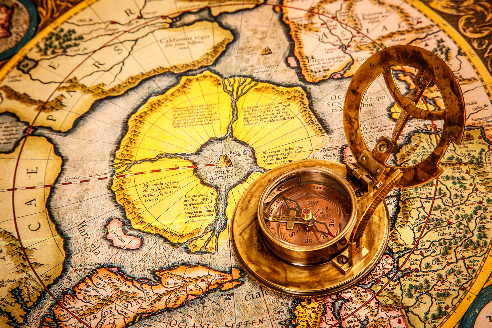
Today, detailed maps of almost any part of the world are available at any time. This has not always been the case. Many centuries ago, maps were rare and much more precious. Thousands of years ago, there were hardly any maps at all. The history of mapmaking is closely related to the history of human civilization and human knowledge. Maps show what a group of people in a particular area knew at the time. They reveal that group’s perspective on the world, their knowledge of the terrain, and their priorities.
今日,世界のほぼどの地域のものでも,詳細な地図がいつでも手に入ります。これは常にそうだったわけではありません。何世紀も前には,地図は珍しく,(現在より)ずっと貴重なものでした。何千年も前には,地図はほとんどまったくなかったのです。地図製作の歴史は,人間の文明や人間の知識の歴史と密接に関係しています。地図は特定の地域の人々の集団が当時知っていたこと〔当時何を知っていたか〕を教えてくれます。地図は,その集団の世界観,地形についての知識,そして優先事項を明らかにするのです。

- rare
- mapmaking
- relate(d)
- civilization
- reveal
- perspective
- priority, priorities

Section 1 : True or False ?

(1) T / F
(2) T / F
(1) Many centuries ago, detailed maps of the world were available to everyone.[F]
(2) We can learn from maps the perspective a group of people in a particular area had at the time.[T]

Section2
Q Why did the Babylonians need maps?

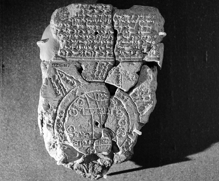
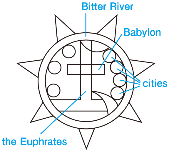
The first known maps of the world are found on Babylonian clay tablets dating from around 600 B.C. Babylonians grew various crops and exported their surplus agricultural products to neighboring areas to trade for other goods. Because of the success of their trade, they wanted to know more about their surroundings. People in these ancient times believed that the Earth was flat and that their lands were circular. In this early Babylonian world map, Babylon is placed at he center. The circles on the map show the major cities. The lines show rivers and the large circle around the cities is the ocean, which they called the “bitter river.”
知られている最初の世界地図は,紀元前 600 年頃にさかのぼるバビロニアの粘土板に見られます。バビロニア人はさまざまな作物を育て,近隣の地域の他の品物と取引するための余剰農産物を輸出しました。取引が成功したので,彼らは自分たちを取り巻く環境についてもっと知りたいと考えました。このような古代の人々は,地球は平坦であり,自分たちの土地は円形であると信じていました。この初期のバビロニアの世界地図では,バビロンが中心に配置されています。地図上の円は主な都市を表しています。線は川を表し,都市の周囲の大きな円は海洋です。彼らはそれを「苦い川」とよびました。

- Babylonian バビロニア(人,語)の
- clay
- tablet(s)
- crop(s)
- export(ed)
- surplus
- neighboring
- surrounding(s)
- circular
- Babylon バビロン(バビロニア地方の古都)

Section2 : True or False ?

(1) T / F
(2) T / F
(3) T / F
(1) The oldest known maps of the world are found on Babylonian clay tablets.[T]
(2) The early Babylonian world map was based on the idea that the Earth was flat.[T]
(3) Babylon is drawn at the top of the Babylonian world map.[F]
Section3
Q What was the idea that began to spread in ancient Greece and influenced maps there?

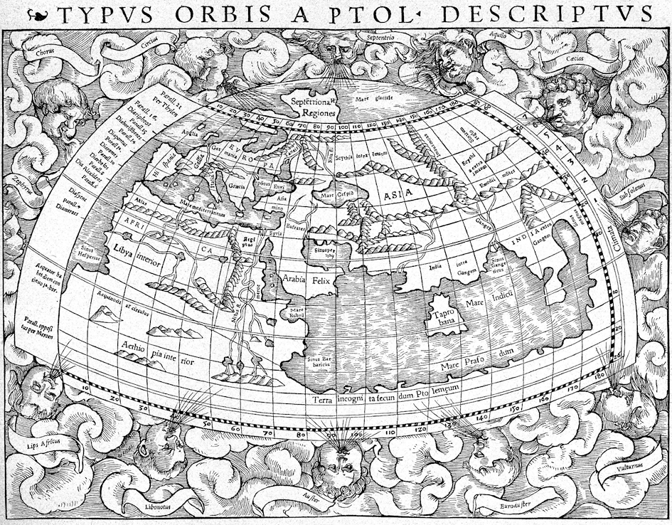
As knowledge of the Earth’s geography grew, maps became more detailed. In ancient Greece, the study of astronomy made great advances thanks to Aristotle and other philosophers. Around 330 B.C. Aristotle began to accept the idea that the Earth was a sphere. The Greek scholar Ptolemy incorporated this idea in his book, in which he tried to project the round Earth onto a flat surface. He showed different points on the Earth in relation to lines of latitude and longitude. This idea influenced the making of maps for many centuries afterward.
地球の地理に関する知識が増えるにつれて,地図はさらに詳細になりました。古代ギリシアでは,アリストテレスやその他の哲学者たちのおかげで,天文学の研究が大きな進歩を遂げました。紀元前 330 年頃,アリストテレスは地球が球体であるという考え方を受け入れ始めました。ギリシアの学者プトレマイオスはこの考え方を自身の著書に取り入れ,その中で丸い地球を平面に投影しようと試みました。彼は,地球上のさまざまな地点を,緯度および経度の線との関係で示しました。この考え方がその後何世紀もの間,地図の製作に影響を与えたのです。

- astronomy
- Aristotle アリストテレス(古代ギリシアの哲学者)
- philosopher(s)
- sphere
- Greek
- scholar
- Ptolemy プトレマイオス(天動説を唱えたギリシアの天文学者,数学者,地理学者)
- incorporate(d)
- onto
- in relation to
- latitude
- longitude
- making
- afterwards

Section3 : True or False ?

(1) T / F
(2) T / F
(1) The idea that the Earth was a sphere was never accepted in ancient Greece.[F]
(2) The Greek scholar Ptolemy tried to project the round Earth onto a flat surface.[T]
Section4
Q During the Middle Ages, how did Christianity influence thought in Europe?

The influence of Christianity in Europe was strongest during the Middle Ages. There was a shift in thought away from the natural science that had prevailed in ancient Greece toward a Christian worldview that accepted the Bible as fact. This resulted in a return to the flat Earth theory.
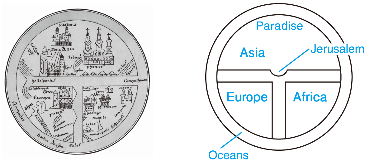
Many of the earliest maps during this era were drawn in the T-O style. A “T-O” map is a large circle with a T-shape dividing the area within the circle into three sections. The uppermost part of the map showed Paradise. Jerusalem was placed at the center of the map, as it was thought to be the center of civilization. The three sections of the map were Asia (the largest), Europe and Africa, while the T represented the seas and rivers that divided them. The large O represented the oceans around the continents.
ヨーロッパにおけるキリスト教の影響は,中世の間に最も強くなりました。古代ギリシアで広まっていた自然科学から離れて,聖書を事実として認めるキリスト教的世界観への思想の転換が見られました。この結果,地球平面説への回帰が生じたのです。
この時代の最も初期の地図の多くは,T-O 型で描かれていました。「T-O」地図とは,大きな円に,円の内側の領域を 3 つの部分に分ける T 字形のあるものです。地図の最も上の部分は天国を示していました。エルサレムが地図の中央に配置されましたが,それはエルサレムが文明の中心であると考えられていたからです。地図の 3 つの部分はアジア(最大部),ヨーロッパ,そしてアフリカであり,T 字形はそれらを隔てる海や河川を表していました。大きな O は大陸の周囲の海洋を表しました。

- Christianity
- the Middle Ages
- prevail(ed)
- worldview
- the Bible
- era
- section(s)
- uppermost
- paradise
- Jerusalem エルサレム(パレスチナ地方の古都)

Section4 : True or False ?

(1) T / F
(2) T / F
(3) T / F
(1) Christianity's influence on the worldview in Europe was strongest during the Middle Ages.[T]
(2) Paradise was drawn in the center of T-O maps.[F]
(3) On a T-O map, the T represented the seas and rivers that divided Asia, Europe and Africa.[T]
Section5
Q How did the style of mapmaking change in the latter part of the Middle Ages?

However, in the latter part of the Middle Ages, the simple Christianity-based maps were succeeded by more scientifically accurate maps. The development of sea-based trade greatly influenced this trend. In the 12th century sea trade flourished, especially between countries around the Mediterranean, leading to a greater demand for maps. The contacts European traders had with other countries, including those in the Islamic world, helped them add new and more accurate information to their maps. Marco Polo’s trips to Asia in the late 13th century also stimulated European interest in exploring and knowing the geography of other regions.
ところが中世の後半には,キリスト教に基づいた簡潔な地図に続いて,もっと科学的に正確な地図が現れました。海を拠点とした貿易の発達がこの傾向に大いに影響を与えました。12 世紀になると,とりわけ地中海周辺諸国の間で海上貿易が栄え,地図の需要の増大につながりました。ヨーロッパの貿易業者が,イスラム世界の国々も含めた他の国々と行った交流は,彼らの地図に新しく,いっそう正確な情報を加えるのに役立ちました。13 世紀終盤におけるマルコ・ポーロのアジア旅行もまた,他の地域の地理を調査し,知ることへのヨーロッパ人の関心を刺激したのです。

- scientifically
- accurate
- sea-based
- flourish(ed)
- the Mediterranean
- trader(s)
- Marco Polo マルコ・ポーロ(イタリアの商人,旅行家)
- stimulate(d)
- explore, exploring

Section5 : True or False ?

(1) T / F
(2) T / F
(1) As sea-based trade grew between countries, the demand for maps increased.[T]
(2) In the 12th century, European traders had no contacts with people in the Islamic world.[F]
Section6
Q What were two major developments during the Renaissance that influenced mapmaking in the West?

During the Renaissance, two major developments led to huge advancements in the accuracy and availability of maps in the West.
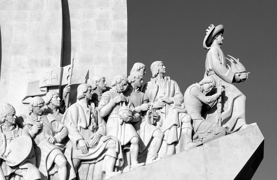
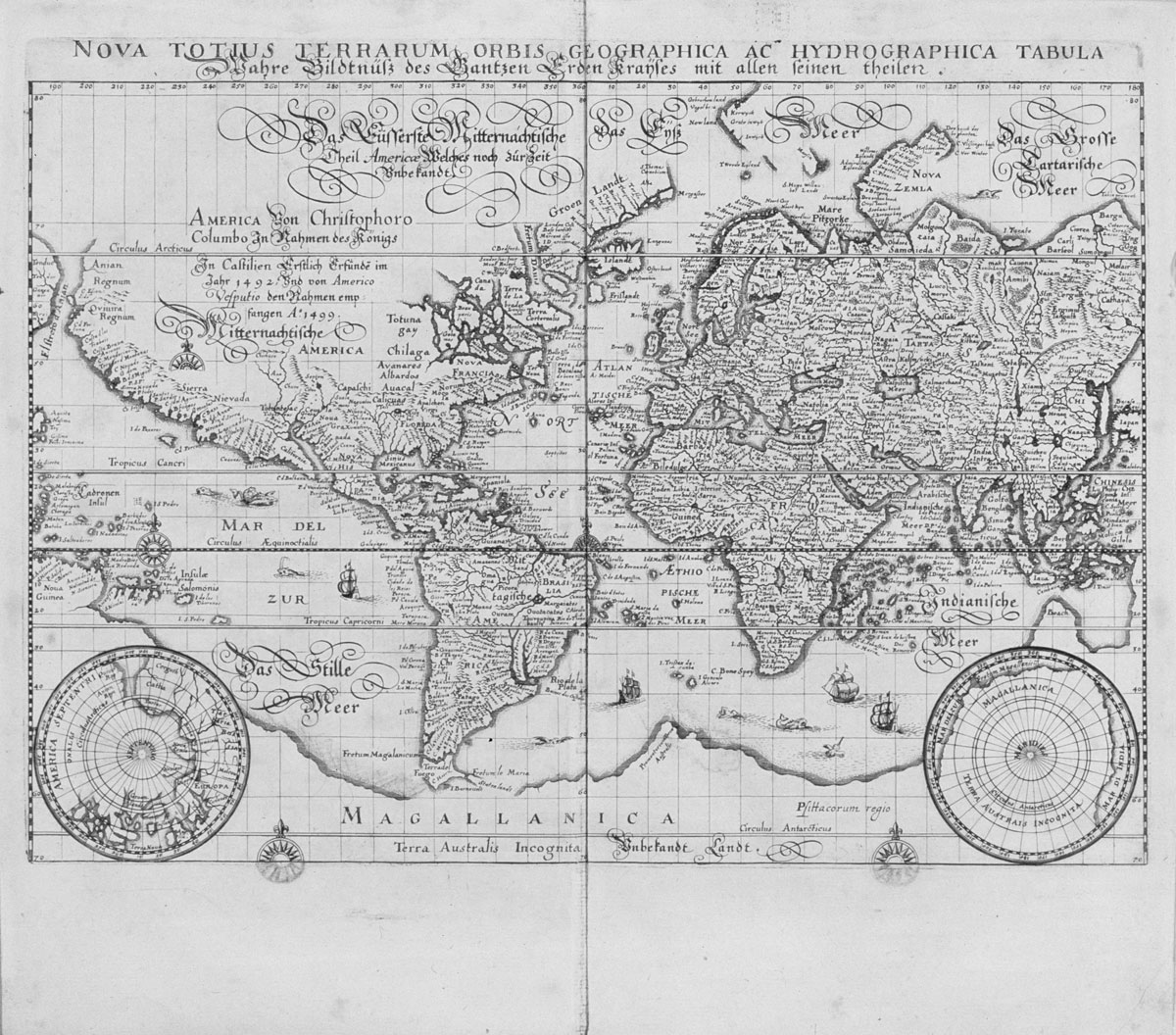
The first was the Age of Discovery, the period from the 15th to the 17th centuries during which explorers from Europe traveled the globe and made contact with all the continents. Spain and Portugal led this activity. Many of the ships had mapmakers on board who carefully noted the characteristics of each area they visited. This was particularly important as empires started establishing colonies in remote parts of the world.
The second development was the invention of the printing press, which allowed large numbers of people to share ever more detailed and accurate maps. In this age, with intellectual curiosity throughout the world increasing, there was a distinct shift in maps from the religious to the mathematical. The greater emphasis on scientific knowledge also helped spread the idea that the Earth was round, not flat.
ルネサンス期に,2 つの大きな発展が,西洋における地図の精度や入手しやすさに多大な進歩をもたらしました。
1 つ目は大航海時代,つまり 15 世紀から 17 世紀にかけての時期で,この間,ヨーロッパからの探検家たちが世界を旅し,すべての大陸と接触しました。スペインとポルトガルがこの活動の先頭に立ちました。船の多くには,訪れるそれぞれの地域の特徴を注意深く書き留める地図製作者が乗船していました。これは,各帝国が世界の遠く離れた地域に植民地を築き始めていたので,とりわけ重要なことでした。
2 つ目の発展は印刷機の発明で,これによって多くの人々がこれまで以上に詳細かつ正確な地図を共有できるようになりました。この時代には,世界中で知的好奇心が高まりつつあったので,地図には宗教的なものから数学的なものへの明確な転換が見られました。科学的知識がよりいっそう重要視されたことはまた,地球は平らではなく丸いのだという考え方を広めるのに役立ったのです。

- the Renaissance ルネサンス(14 -16世紀にヨーロッパで広まった古典芸術・文化の復興運動)
- advancement(s)
- accuracy
- availability
- the Age of Discovery 大航海時代(15 -17世紀にヨーロッパ諸国が海外進出に乗り出した時代)
- explorer(s)
- globe
- mapmaker(s)
- board
- on board
- characteristic(s)
- remote
- invention
- printing press
- intellectual
- curiosity
- mathematical

Section6 : True or False ?

(1) T / F
(2) T / F
(1) The printing press made detailed maps available to many people.[T]
(2) During the Renaissance, maps shifted from a mathematical perspective to a religious perspective.[F]
Section7
Q How did Mercator’s map change the method of navigating across the sea?

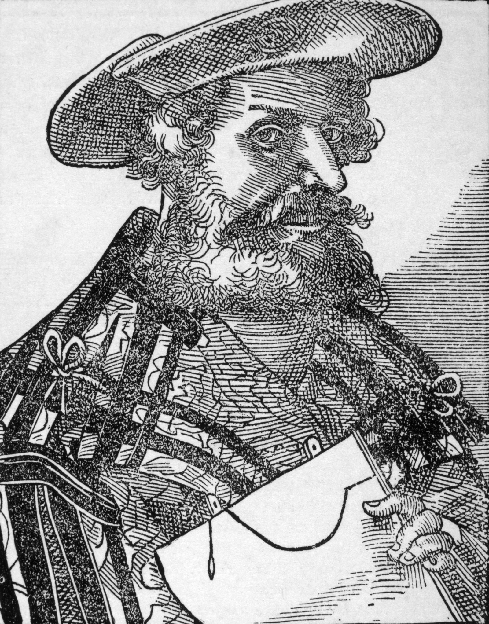
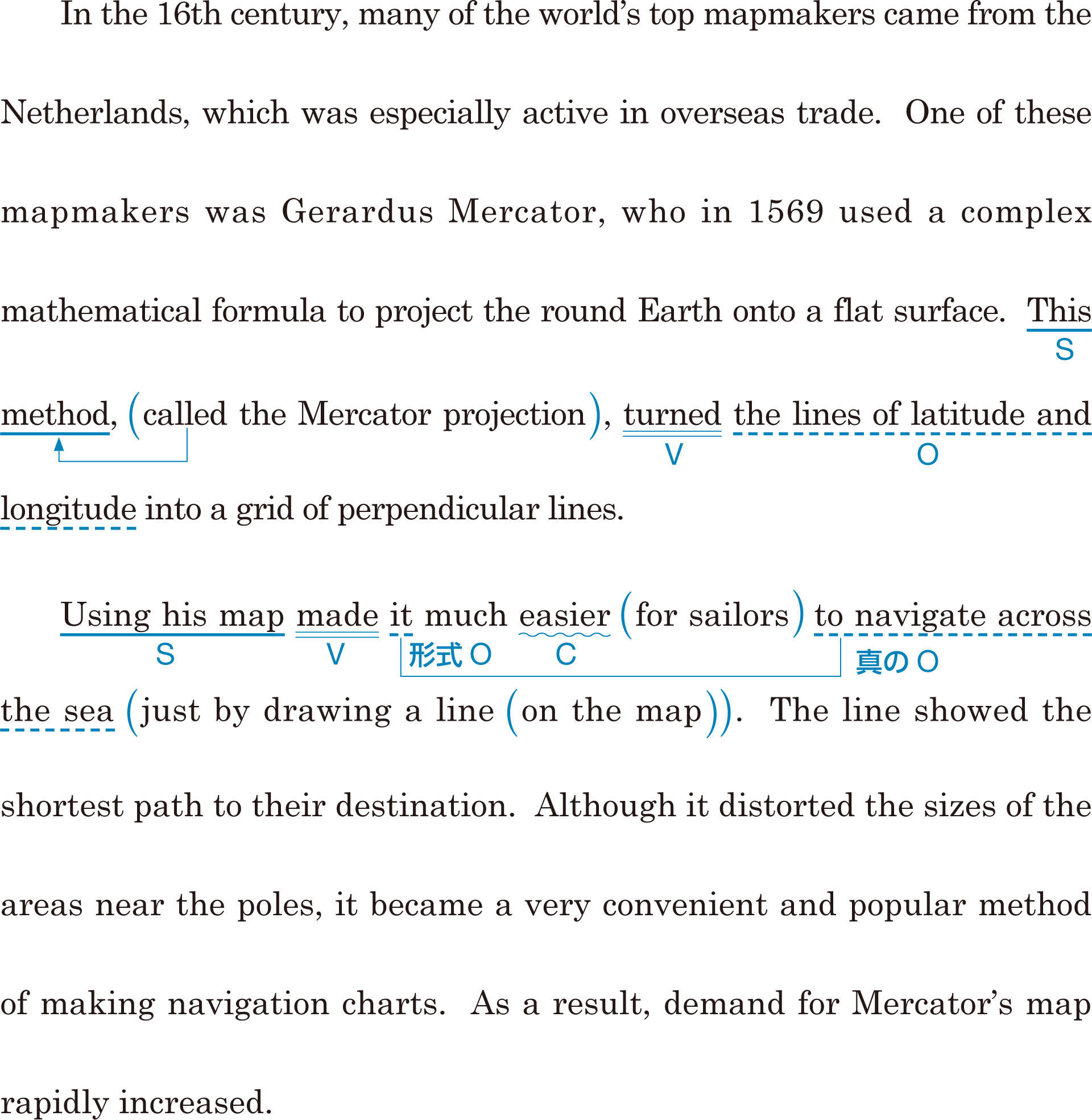
In the 16th century, many of the world’s top mapmakers came from the Netherlands, which was especially active in overseas trade. One of these mapmakers was Gerardus Mercator, who in 1569 used a complex mathematical formula to project the round Earth onto a flat surface. This method, called the Mercator projection, turned the lines of latitude and longitude into a grid of perpendicular lines.
Using his map made it much easier for sailors to navigate across the sea just by drawing a line on the map. The line showed the shortest path to their destination. Although it distorted the sizes of the areas near the poles, it became a very convenient and popular method of making navigation charts. As a result, demand for Mercator’s map rapidly increased.
16 世紀には,世界最高の地図製作者たちの多くが,オランダ出身でした。オランダでは海外貿易が特に活発でした。こうした地図製作者たちの 1 人がゲラルドゥス・メルカトルで,彼は 1569 年に,複雑な数式を利用して丸い地球を平面に投影しました。メルカトル投影法とよばれるこの方法は,緯度と経度の線を垂直線の格子に変えました。
彼の地図を使えば,地図に 1 本の線を引くだけで,海をわたって航行することが船員たちにとってはるかに楽になったのです。その線は彼らの目的地への最短経路を示しました。その地図は南北両極に近い地域の寸法をゆがめていたにもかかわらず,非常に便利で人気の高い航海用海図製作の方法になりました。結果として,メルカトルの地図の需要は急速に増加したのです。

- Gerardus Mercator ゲラルドゥス・メルカトル(オランダの地理学者)
- complex
- the Mercator projection
- grid
- perpendicular
- navigate
- distort(ed)
- pole(s)
- navigation

Section7 : True or False ?

(1) T / F
(2) T / F
(1) In the 16th century, the Netherlands produced many of the world's top mapmakers.[T]
(2) Mercator's map was not appropriate for making navigation charts.[F]
Section8
Q What factors have helped to make modern maps almost perfect?

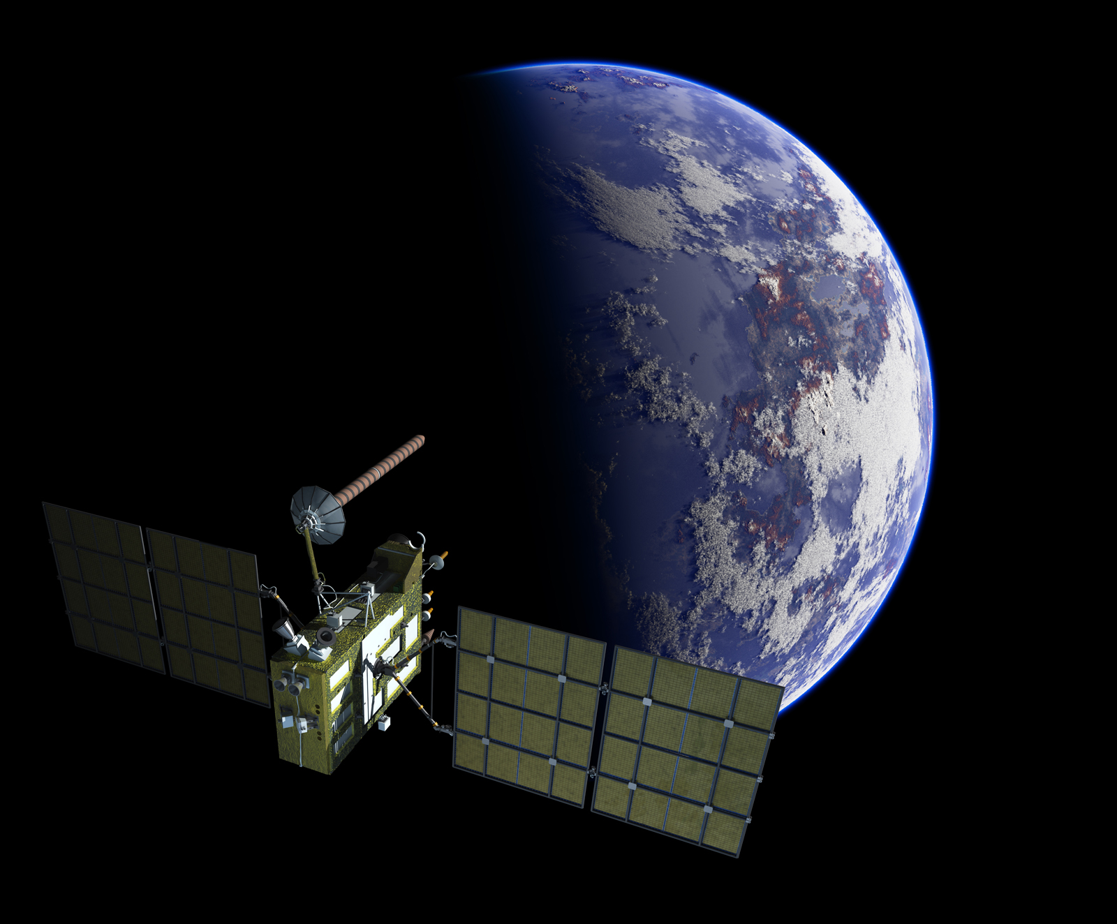
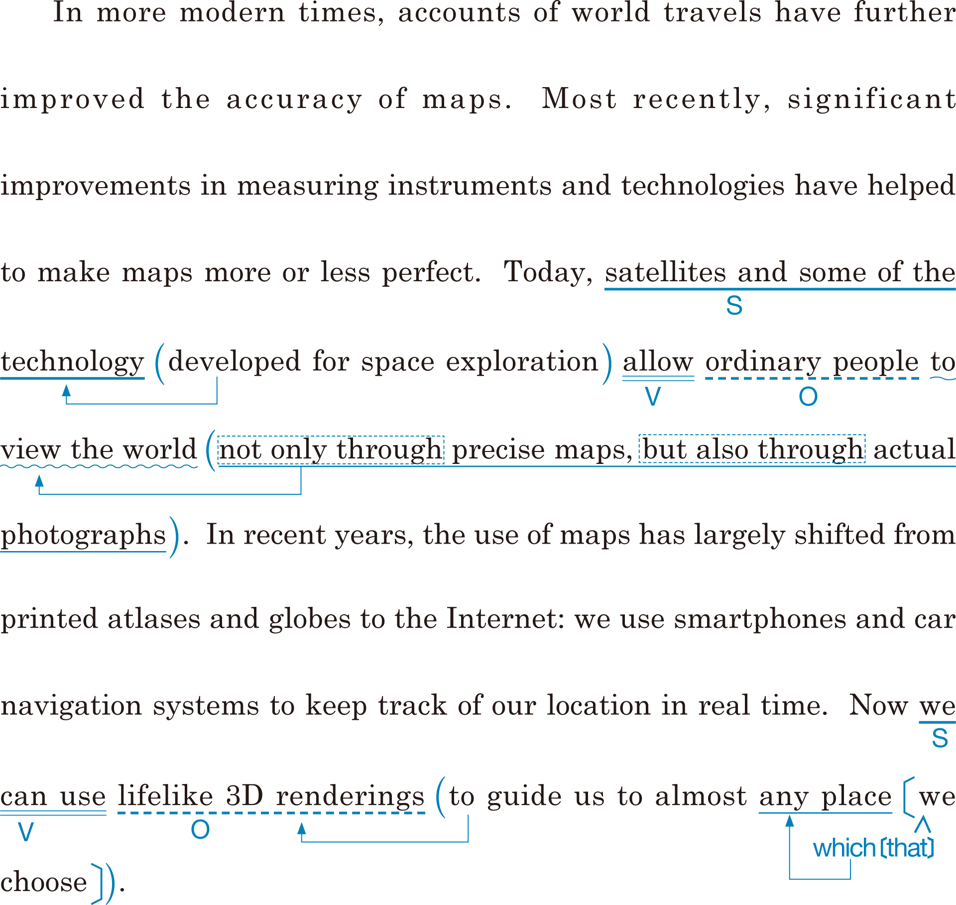
In more modern times, accounts of world travels have further improved the accuracy of maps. Most recently, significant improvements in measuring instruments and technologies have helped to make maps more or less perfect. Today, satellites and some of the technology developed for space exploration allow ordinary people to view the world not only through precise maps, but also through actual photographs. In recent years, the use of maps has largely shifted from printed atlases and globes to the Internet: we use smartphones and car navigation systems to keep track of our location in real time. Now we can use lifelike 3D renderings to guide us to almost any place we choose.
さらに近代になると,世界旅行の記述が地図の正確さをさらに改善してきました。ごく最近では,計測器や科学技術の著しい向上が地図をほとんど完璧なものにするのに役立ってきました。現在は人工衛星や宇宙探査用に開発された科学技術の一部のおかげで,一般の人々が,精密な地図を通してだけでなく,実際の写真を通しても世界を見ることができます。近年においては,地図の利用は印刷された地図帳や地球儀からインターネットへと大きく変化してきました。私たちはスマートフォンやカーナビを使って自分の現在位置を把握することができます。今や私たちは本物そっくりの 3 次元で表現された画像を使って自分たちが選ぶほぼどんな場所へも行くことができます。

- account(s)
- improvement(s)
- more or less
- precise
- actual
- atlas(es)
- track
- keep track of
- lifelike
- 3D
- rendering(s)

Section8 : True or False ?

(1) T / F
(2) T / F
(1) Today, thanks to satellites and the latest technology, people can view the world through actual photographs.[T]
(2) Although smartphones and car navigation systems are popular, we never see 3D renderings of places.[F]
Section9
Q What may the development of maps encourage people to do in the future?

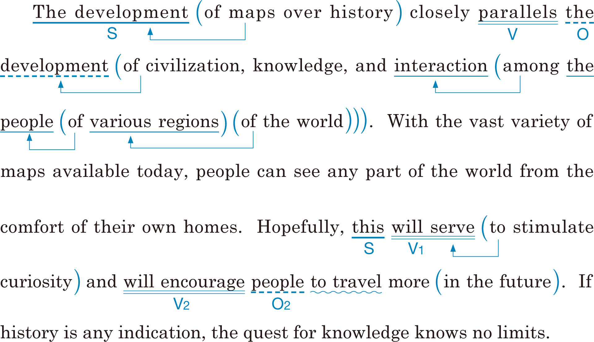
The development of maps over history closely parallels the development of civilization, knowledge, and interaction among the people of various regions of the world. With the vast variety of maps available today, people can see any part of the world from the comfort of their own homes. Hopefully, this will serve to stimulate curiosity and will encourage people to travel more in the future. If history is any indication, the quest for knowledge knows no limits.
歴史を通じて地図の発達は,文明,知識,そして世界のさまざまな地域の人々どうしの交流の発達と同時に起こっています。今日では膨大な種類の地図が利用できるので,人々は自宅でくつろいだまま,世界のどの地域をも見ることができるのです。このことが好奇心を刺激する役割をし,人々が将来もっと旅行したくなることが望まれます。歴史が示すことを見れば,知識の探求には限りがないと言えるでしょう。

- vast
- comfort
- indication
- quest

Section9 : True or False ?

(1) T / F
(2) T / F
(1) The development of maps is closely related to that of human civilization.[T]
(2) The availability of various maps will stop people from traveling.[F]

